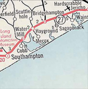
For centuries maps have served as vital tools for place representation, communicating as much about who we are as well as the world we inhabit. They have taken many shapes and forms, in a variety of media, including today’s complicated 3 D computer based versions. Every map can be viewed as an historic artifact representing not only what we see, but how we see it. Maps generated for wayfinding whether it be for pilgrimage, commerce or warfare, have been a keen preoccupation at least since the early Middle Ages.
The appearance of the earliest roadmaps in America coincide with the tremendous success and affordability of Ford’s Model T automobile in 1908. Within just a few short years, over one million automobiles were on the road and with this increase came a desire to explore the country. Traveling by automobile in America in the early decades of the 20th century was extremely difficult on the infant road network. However by the late 1920s the country was committed to providing paved and well-marked highways and the roadmap thus became a critical tool for navigation. The advent of the automobile afforded a new personal mobility and liberation that other forms of transportation had not allowed. The open road came to represent freedom, boundless possibilities ahead, spontaneity, and unplanned discoveries.
Although the concept of the free map was first exploited by the railroad companies in an effort to promote other services including lodging, food, and tourist attractions, the itineraries were simple and schematic given the set route of the traveler. As the automobile superseded trains for leisure travel, the road map replaced the railroad timetable and travelers were free to follow any route at their own pace. Like the railroad, oil companies recognized the value of the free roadmap. With a map in hand, Americans could travel more and consume more, buying not only gas and oil but associated tourist services such as food, lodging and souvenirs. Maps included more than the network of local, state and interstate roads including the locations of the company gas stations in characteristic logo branding such as the Texaco star (on the Terrazzo road map) as well as local scenic and historic attractions.
The oil company roadmap was arguably one of the most effective marketing tools and greatest commercial artifacts of twentieth century American culture as Americans hit the road in record numbers after World War II. By the 1950s, the population explosion from the post-war Baby Boom Era created a new force in American life reflected in cover artwork that was often family oriented with scenes of the utopian family road trip. By traveling the country and seeing America first, Americans could become better citizens.
The construction of the Interstate highway system in 1955 suddenly ushered in a new era of automobile travel that was designed to be a quicker and more efficient way to travel. By the sixties, the superhighway system was in full operation and would fundamentally change long distance driving in the US thereafter. Gone were the days of an extended road trip, often with camper or trailer in tow. The objective of the new limited access highway system was simply to reach one’s destination as quickly as possible. With so many more motorists on the road, the oil companies no longer needed to entice drivers with perks such as free maps and service. By 1973, the oil crisis and embargo spelled the final doom for the free roadmap.